With each passing day, fall is asserting itself more and more. But even though the days are getting shorter and shorter, I’m still going to take a chance and write about two more one-day road trips today.
Let’s start, perhaps, with a route that—given its length—can honestly be called “challenging.” It’s a long drive ahead, but there are plenty of interesting places to see. If you’re a true fan of traveling through Sloboda Ukraine, I’m sure the challenges won’t stop you. The distance from Kharkiv to the first stop is about 220 km. But trust me, it’s worth the drive. As is our tradition, we set out at the crack of dawn; outside the window, the familiar and beloved towns of Bohodukhiv, Okhtyrka, Trostyanets’, and Boromlia rush by… Just before reaching Verkhnia Syrovatka, we turn left. We pass through Chervnoe (Stare Selo)—whose estates have already been written about—and Hirne. Then we turn south and drive past a village with the lovely name of Kharkivshchyna. In Shpylivka, you can make a short stop if you wish. It is believed that this settlement was founded in 1697. It was owned by members of the Kondratyev and Rimsky-Korsakov families. The stone Pokrovsky Church, rebuilt in 1850, once housed the icon of the Mother of God of Korsun, which had long been venerated throughout the surrounding area.
There was also a brewery and meadery. Nothing of this has survived to the present day. The only example of historic architecture still standing is the building of the zemstvo school, built in 1912. Shpylivka’s main attraction, however, is its beautiful natural surroundings, which draw many artists to the village for plein air painting. The village also has its own Lysa Hora (Bald Mountain), which is the subject of many mystical legends. But keep an eye on the time—the stop in Shpylivka, I repeat, is optional. The same applies to the Lyfyne Estate, which we’ll pass on the way. After all, the main destination of our trip is the oldest lake in our country, often mentioned in various “Top Most Beautiful Lakes of Ukraine” lists.
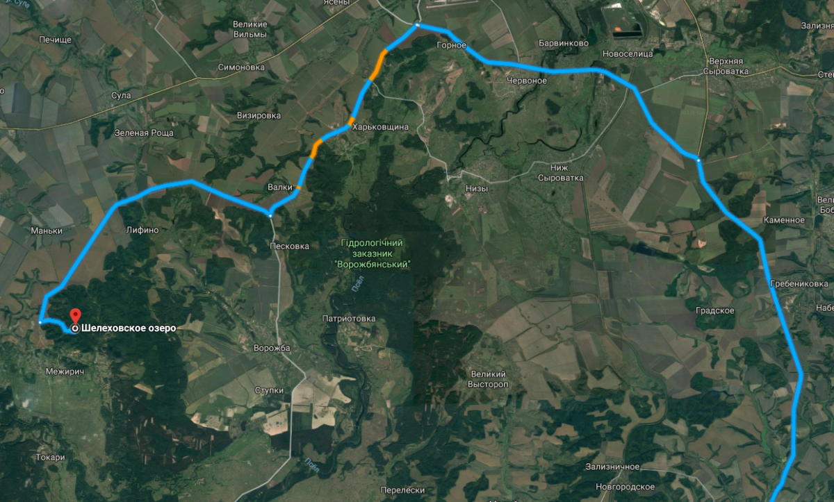
This is where the real fun begins. First of all, there’s practically no road—not even what we call a “road” in our country—leading to Lake Shelehivske. Second, when we were in Lyfyne last year, the locals answered the question “How do I get to the lake?” very succinctly: “Leave Lyfyne, then go straight ahead. And when the paved road starts, there’ll be a right turn, and there’s a sign there with the directions.” The key phrase was precisely “when the paved road starts.”
In other words, at first you’re driving along a dirt road, and sandy-clay dust is whipping into the windows. Then (watch out!) the gravel begins. But that’s not all. Next comes the scariest part—the turns. Personally, we took a wrong turn about five or six times. That’s because the long-awaited sign indicating the turn toward the lake looks extremely modest and unassuming—specifically, like this (at least, in 2017):
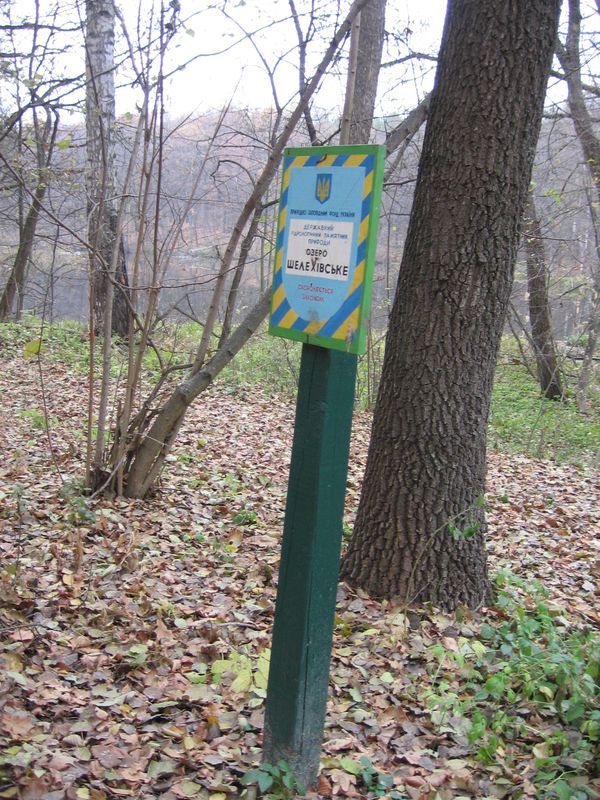
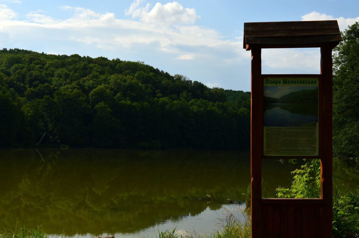
Important note! If it rained before or during your trip, you shouldn’t continue on. Even if you’re in an SUV. Even if there are just the two of you—trust me. But if the weather is on your side, the lake will delight you. It’s nestled deep within a dense forest, home to an extraordinarily rich variety of flora and fauna. On the shores themselves, there are several gazebos set up for relaxation, one of which is located on a small island and connected to the shore by a wooden bridge. An information stand located there informs all travelers that:
Lake Shelehivske is a hydrological natural monument of national significance, formed during the Ice Age. Massive mountain shifts blocked the path of meltwater and created a glacial lake covering an area of 7 hectares. To this day, the lake has retained the cold it inherited from the glacier. It was here, in the mid-17th century, that Cossack settlers from the Right Bank arrived, led by Centurion Shelehivsky (from whom the lake takes its name), to later found the fortress town of Mezhyrich, which subsequently became one of the centers of Ukrainian pottery. From a bird’s-eye view, Lake Shelehivske resembles an unfurled horseshoe.
After enjoying the beautiful scenery and mentally checking off “I’ve visited Ukraine’s oldest lake,” we head on. It’s not far to the second stop on our trip—only about 5–6 km. Mezhyrich, the headquarters of the Sumy Sloboda Regiment, is famous for many things.
The document titled “Report Compiled by the Sloboda Ukrainian Provincial Chancellery on the Fairs Held in the Sloboda Province in Cities, towns, and settlements—regarding the large, medium, and small fairs held there, when they take place, how long they last, where the goods are brought from, and by which routes they are distributed to buyers in 1779,” we read the following about him:
The town of Mezhyrich hosts three fairs each year: on May 9, the feast day of Saint Nicholas the Wonderworker; on July 8, the feast day of Saint Procopius the Great Martyr; and on September 26, the feast day of Saint Demetrius the Great Martyr. These fairs last 6 or 7 days each, from the start until the end. Merchants bring red goods and other copper and iron wares to these fairs from the cities of Sumy, Lebedyn, Rylsk, and Putivl; they also bring cattle and horses, as well as bread and other food supplies, along with fur coats, cloaks, hats, all kinds of wooden and earthenware tableware, and various types of fish from the Mezhyrich, Sumy, and Lebedyn districts…
It is believed that Stepan Selehov, a centurion from Mezhyrich, had an estate in the vicinity of the lake we are already familiar with. That is precisely why the lake came to be known as Shelehivske. Filaret (D. G. Gumilevsky), whom we know, writes that in 1777 there were eight churches in Mezhyrich: the Cathedral of the Dormition, St. Nicholas Church, and Holy Trinity Church within the city ramparts; and outside the ramparts—the Intercession Church, the Exaltation of the Cross Church, the Archangel Church, the Transfiguration Church, and the Resurrection Church.
At the beginning of the 20th century, there were four churches in Mezhyrich: the Assumption, the Exaltation of the Cross, the Transfiguration, and the Intercession. Of these, only the Assumption Church has survived to this day.
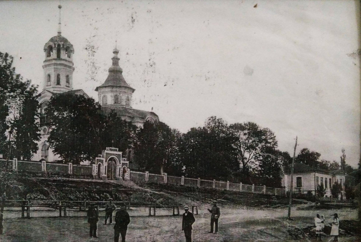
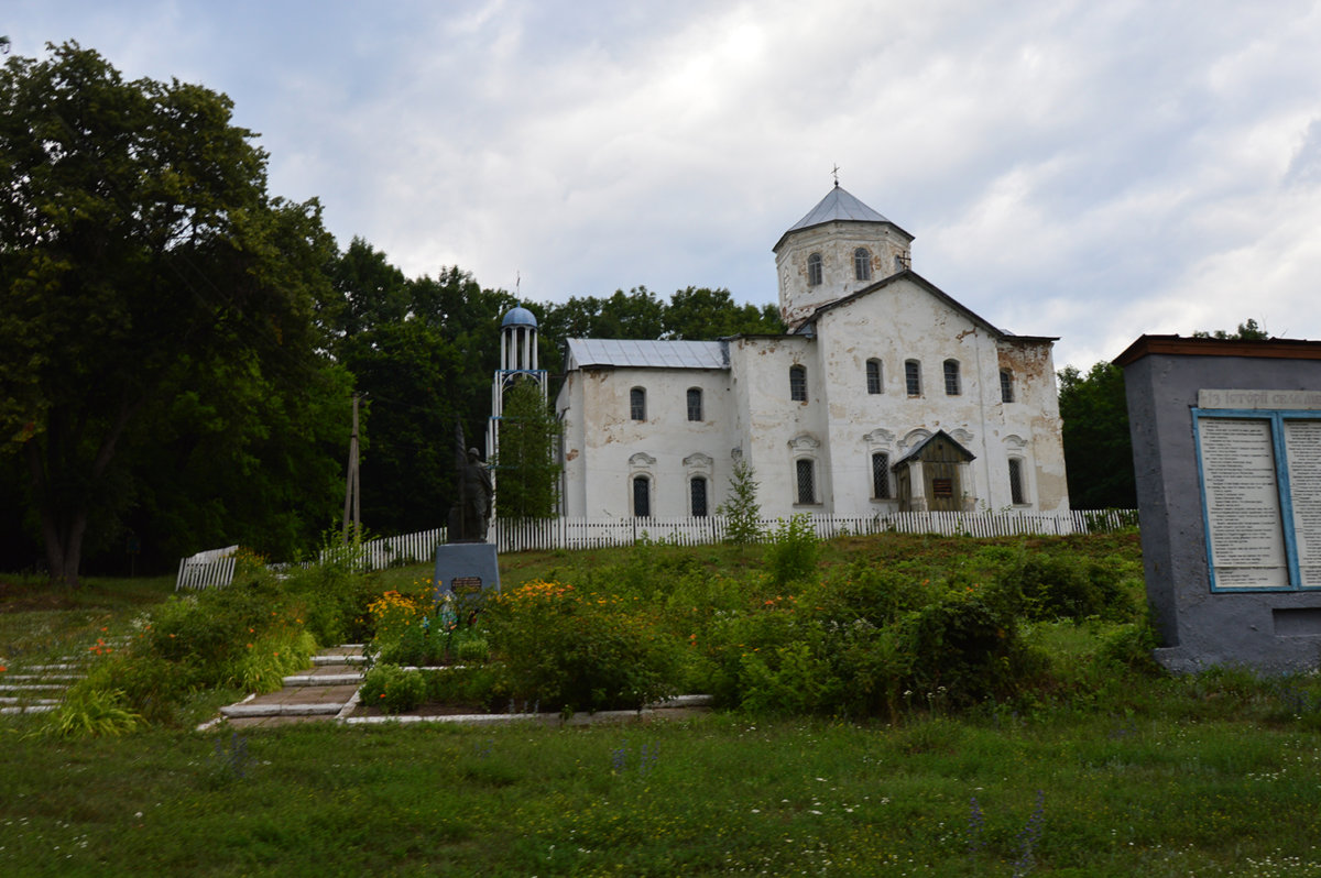
It was founded in 1759 at the request and expense of L. Belous, a native of Mezhyrich who later became the archimandrite of the Kyiv-Pechersk Lavra. The model for the church’s construction was the Assumption Cathedral in Okhtyrka, which has not survived to the present day. The church, which has retained its former grandeur, is considered the main attraction of Mezhyrich. Next to it, in a highly visible spot, stands a tourist information kiosk detailing the village’s glorious history. It is a pity that there are so few such sites in the lands of Sloboda Ukraine.
From Mezhirich, our route takes us to Mikhailovka. After Tokary, a pine forest begins, and if you’re a fan of modern ruins, as well as airsoft and paintball, it’s worth stopping there. The ruins of a Soviet missile base from the Cold War era remain in this area. There are plenty of videos and photos of this place online.

Well, next you’ll have to make an extremely difficult choice. Once you’re on the highway, you can either turn right toward Mikhailovka or turn toward Lebedyn and head home. If you chose the first option and didn’t spend too much time exploring the missile base, the drive from Mezhirich to Mikhailovka will take about 30 minutes. It got its name from its first owner—Colonel Mikhail Vasilyev of Hadyach, the nephew of Hetman Ivan Samoilovich. Later, the settlement came into the possession of Ivan Pavlovich Obidovsky, the nephew of Hetman Ivan Mazepa. He was the very man to whom Mazepa—who had no children of his own—planned to pass on his hetman’s mace. After Mazepa defected to the side of Charles XII, Tsar Peter I granted the wealthy village of Mikhailivka to Chernihiv Colonel Pavel Polubotok, who became acting hetman in 1722. The legendary “Polubotok’s gold” is associated with Mikhailovka. It is believed that it was there, upon receiving news of her husband’s arrest, that Polubotok’s wife hid untold treasures in the cellars of Mikhailivka. Later, through the female line of the Polubotoks, Mikhailovka passed to the Ivanenkos.
Well, in 1852, it passed into the hands of the Kapnist family, who retained ownership until the Bolsheviks came to power. The Kapnist counts significantly improved and expanded the old estate. We can get an idea of what it looked like before 1917 thanks to photographs taken by Grigory Lukomsky, who visited the estate in 1913.
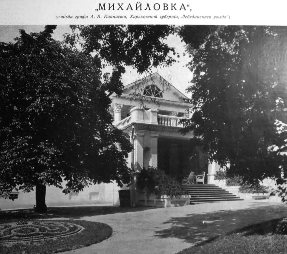
All that remains of its former splendor today is the massive entrance to the estate and a wing that miraculously survived. Also, if you do decide to go there, I would highly recommend reading “Memories of Mikhailivka,” which appears in I. P. Rozhevetsky’s excellent work *Materials on the History of the City of Lebedyn*, before your trip. The book is freely available online, so you won’t have to search for it for long.

The route mentioned above is indeed challenging—both in terms of distance and the number of sites. So, if you’d like to travel but realize you can’t handle that route, here’s a second, “easier” option.
We’ll pass through Bogodukhov and Okhtyrka again. We’ll stop in Trostyanets’ if you’d like. From there, however, we won’t head north as usual, but west. The road there is challenging in places, but beautiful.
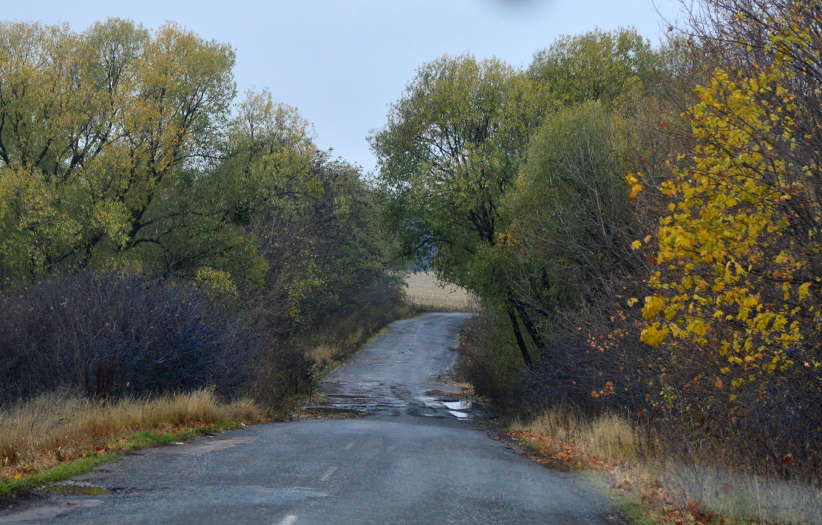
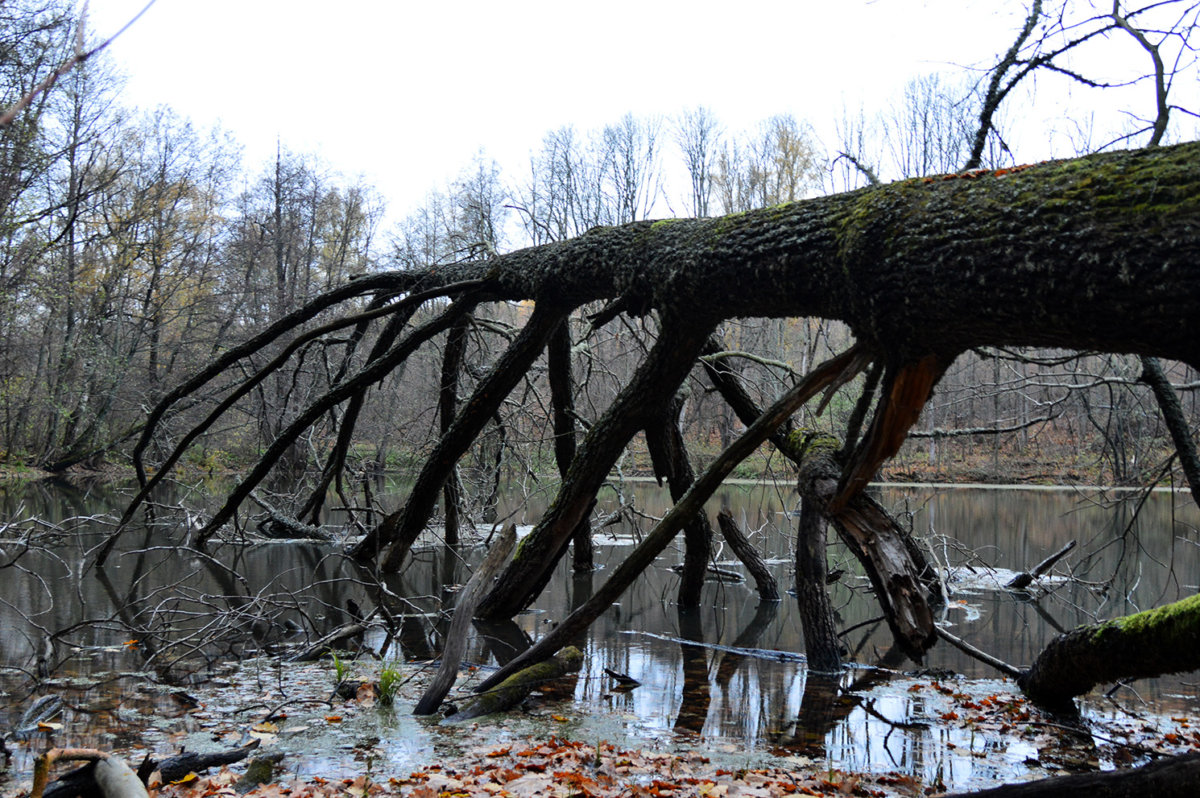
Before the turn toward Vynohradne, there is a small turnoff to the left onto a dirt road. If you take that turn, you can see the remains of the old, abandoned “Alesha” farmstead deep in the forest on the shore of the lake. During the war, quite a few families moved here from Ovodivka, which had been burned down by the Germans. According to information posted online, the remains of buildings are supposedly still there. However, when we visited last year, we found nothing but holes and piles of pre-revolutionary roof tiles. And the mythical farmstead itself is extremely difficult to locate. Nevertheless, the surrounding nature is absolutely beautiful, and it’s still worth the trip if you’re interested.
All in all, whether you stop by or not is up to you. If you’re traveling along the Lebedynske Highway, you’ll reach Ryabushky 28 km past Trostyanets’. In the second half of the 18th century, the village was owned by landowner Ivan Timofeyevich Krasovsky, who built a church and a manor house there. The famous philosopher Hryhorii Skovoroda was a guest at his estate. Ivan Timofeevich’s son, Afanasy, became a general and fought in the Napoleonic Wars, the Russo-Turkish Wars, and the Persian Wars, as well as in the suppression of the Polish Uprising. Today, one of the streets in Ryabushky is named in his honor.
The village’s main attraction is the historic stone Church of St. John the Baptist. It was built on the site of an old wooden church with funds from the parishioners in 1886, based on a design by the outstanding Kharkiv diocesan architect Fyodor Ivanovich Danilov. In 2004, Andrei Paramonov saw it like this:
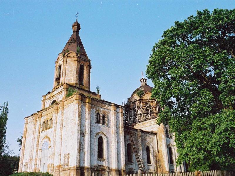
We visited Ryabushky last October:

After driving about 13 km, we arrive in Lebedyn. This town, which was once both a “sotnya” and a uyezd center, still has quite a few historic buildings and churches, just like in Akhtyrka. So, if you’d like, you can stop and wander through the streets. However, the road beckons us onward. After all, the final destination of our journey lies 20 km from Lebedyn. After passing through Budylka and Selishche and admiring the natural beauty near the hydroelectric power plant, we arrive in Bobrovo to finally see the oldest wooden church in Sloboda Ukraine. It was built with funds from parishioners in 1730, then rebuilt in 1846 by the Bukharin landowners, whose stone estate was located nearby. In the church, named in honor of St. Nicholas, the wooden structure was restored and a stone foundation was laid, both funded by Vera Ivanovna Bukharina.
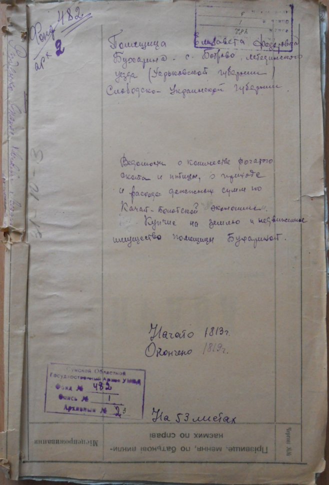
The owners of Bobrovo were people of considerable distinction and wealth. However, not a trace remains today of their beautiful estate or of the stone church built in the cemetery. You can learn a little about how the Bukharins lived by consulting fonds F.482, held at the State Archives of the Sumy Region. Three case files covering the periods 1783–1804 and 1811–1823 contain a great deal of interesting information about Bobrovo.
In 1913, the wooden church looked like this:

I don’t know what this church—which is so important to our history—looks like now, or what remains of it. Last year, we found it in a deplorable state.
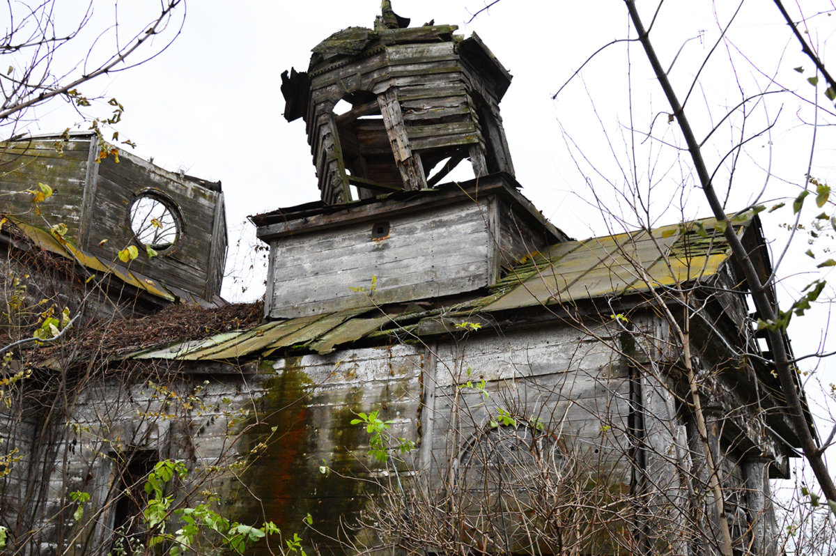
That is exactly why you should visit Bobrovo. After all, there are fewer and fewer structures like the wooden Church of St. Nicholas in the Sloboda Ukraine region with each passing day…

- About the military pilot school and the airfield in Kharkiv… - 04.11.2020
- Nikanor Savich—A Political Career by Mistake - 13.07.2020
- And once again, about the Cavalry Guards… - 21.01.2020