Unique City Maps of the Kharkiv Governorate from the Late 18th Century

Few people know this, but the 1902 Kharkiv calendar contains unique maps of towns in the Kharkiv Governorate from the late 18th century.
For this reason, we humbly present them here…
11025809_1565704650313540_6575332997048023439_n
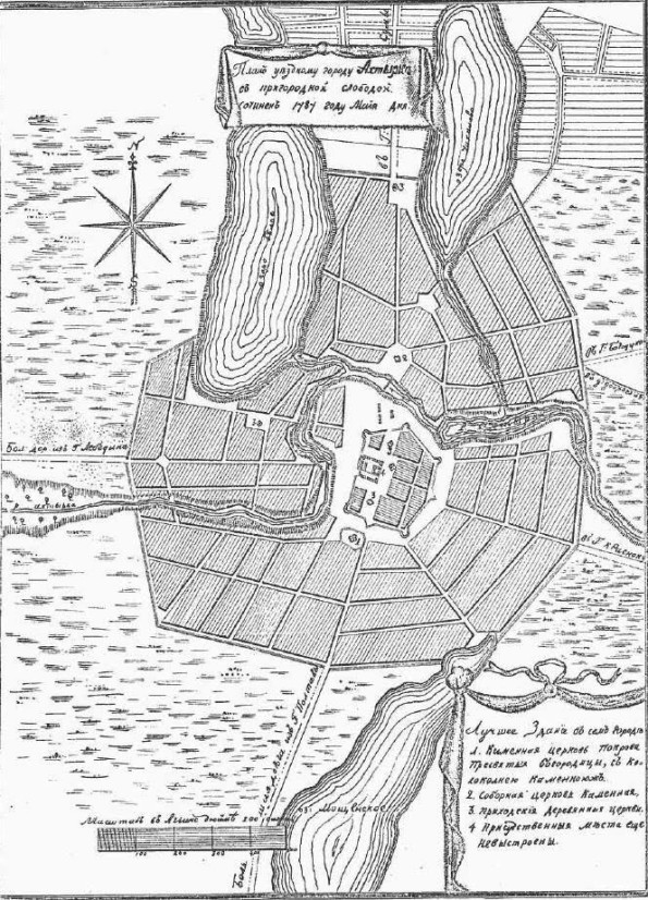
Okhtyrka

1454772_1565704610313544_7408719969988434769_n
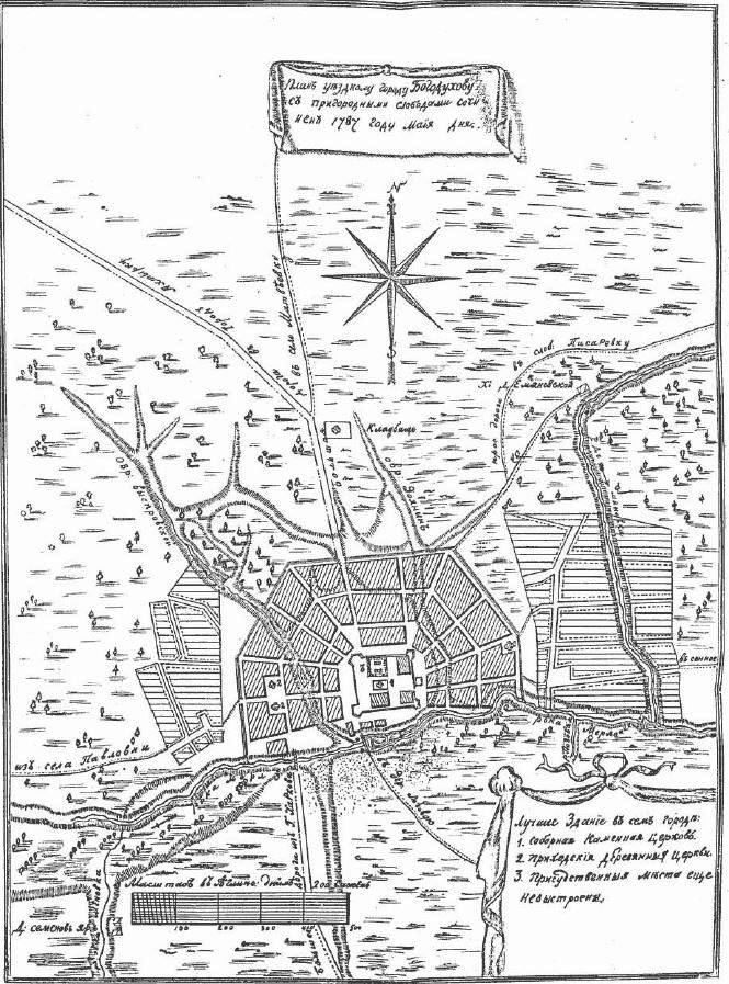
Bohodukhiv

1488054_1565704626980209_364503969616062312_n
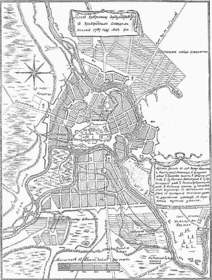
Kharkiv

10408181_1565704930313512_4584056615501766050_n
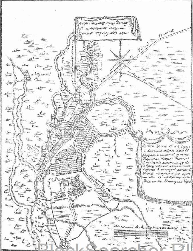
Izyum

11015071_1565704540313551_438072856265952237_n
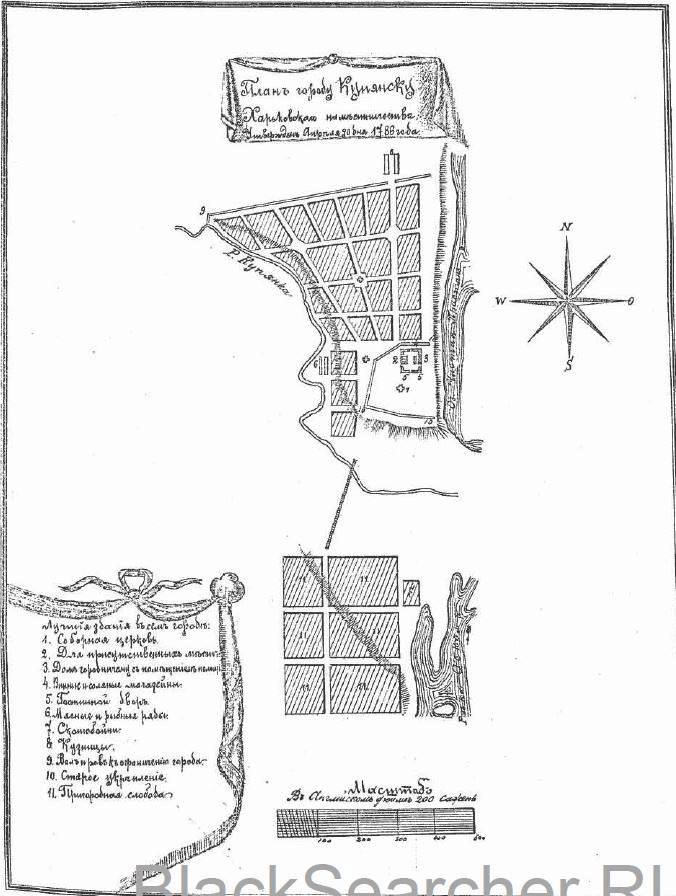
Kup’yans’k

11021113_1565704560313549_7874574449447835239_n
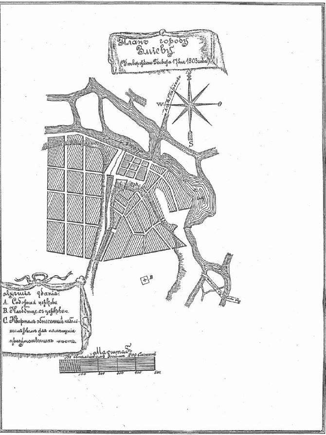
Zmiiv

11025688_1565705060313499_1693955730603914178_n
Krasnokuts’k

11035586_1565704676980204_40967076903155931_n
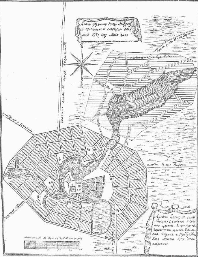
Lebedyn

11036841_1565704703646868_5689722415411559865_n
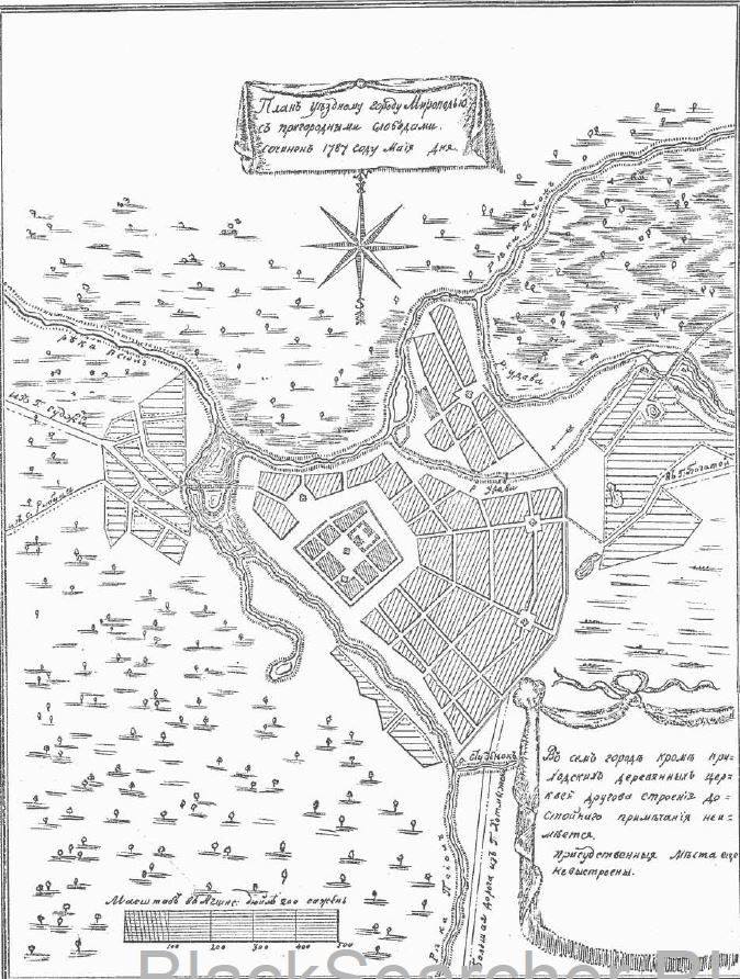
Myropillia

11046737_1565704583646880_9094739573204791833_n
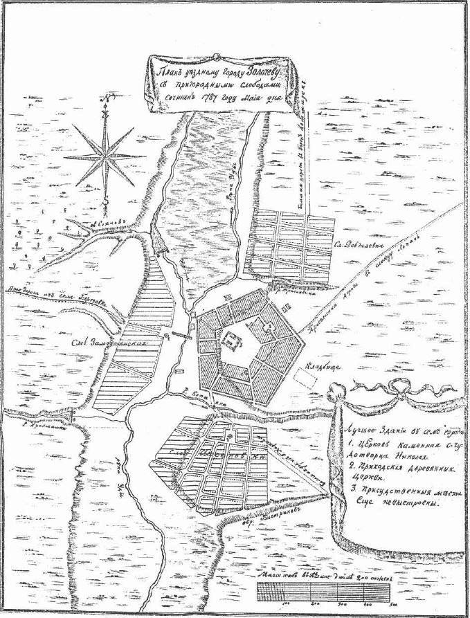
Zolochiv

11054464_1565704713646867_4884555985454337382_n
Vovchansk