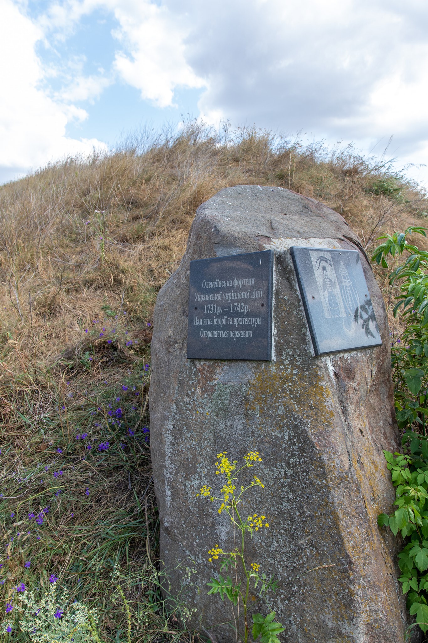
The Oleksiivs’ka fortress was built in 1731. It is located between the village of Oleksiivka and the city of Zlatopil (formerly Pervomaisky) in the Kharkiv Oblast.
There were 12 such fortresses in the Kharkiv region, nine of which are still well-preserved. They formed part of a continuous military engineering system of fortifications, which is referred to as the Ukrainian Line in documents from the 1730s.
The line stretched 302 km from the Siverskyi Donets river to the Dnipro river, with smaller fortifications—redoubts—erected every two km.
There were a total of 16 fortresses along the line (with another 4 located in what are now the Poltava and Dnipropetrovsk regions)
The line served as a defense against Tatar raids and as a strategic stronghold during the Russo-Turkish Wars.
Twenty regiments of the Landmilitia (22,000 men) were assigned to defend the line. The fortress garrison consisted of 600 men; in peacetime, their numbers were reduced, and they lived in settlements nearby.
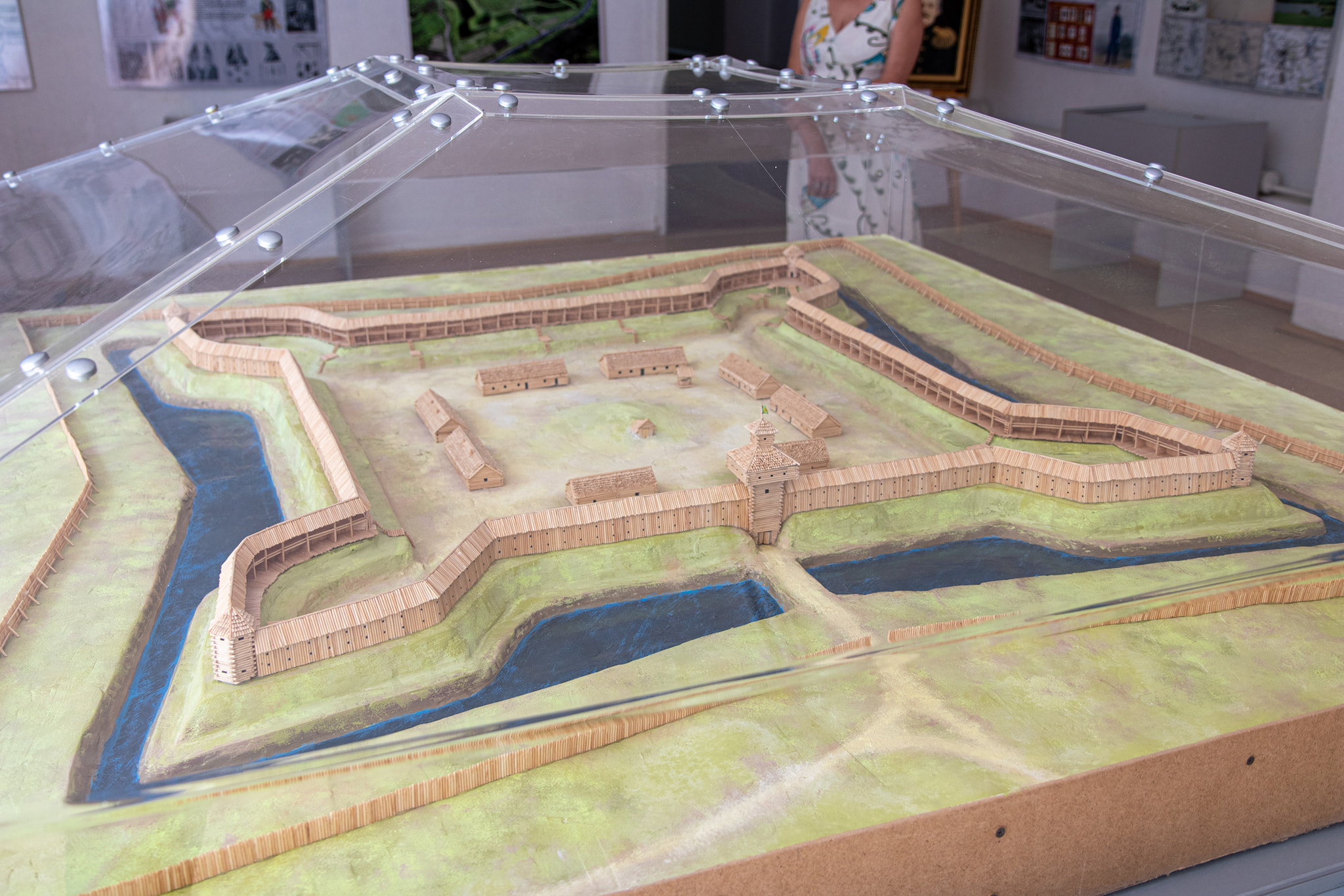
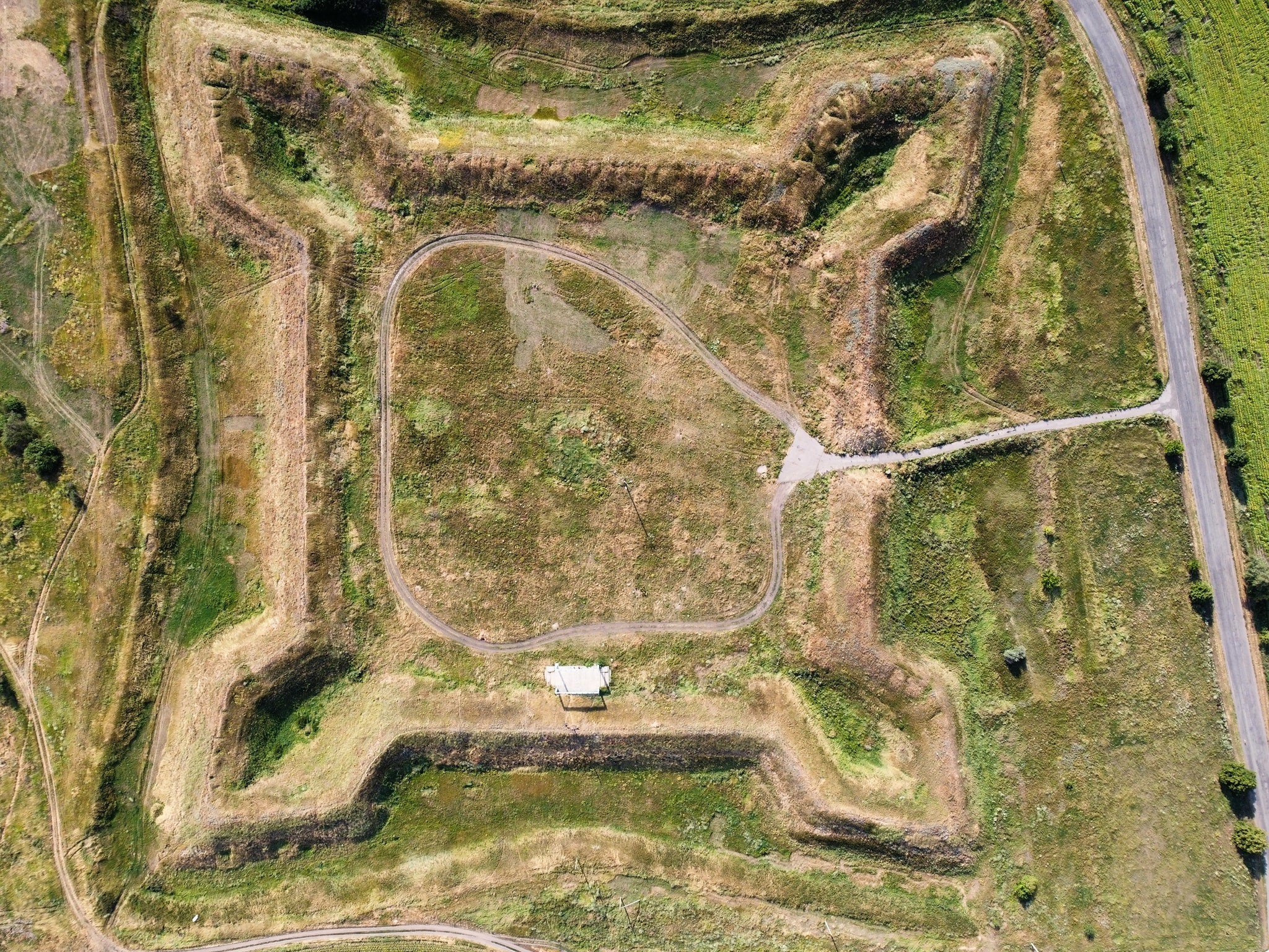
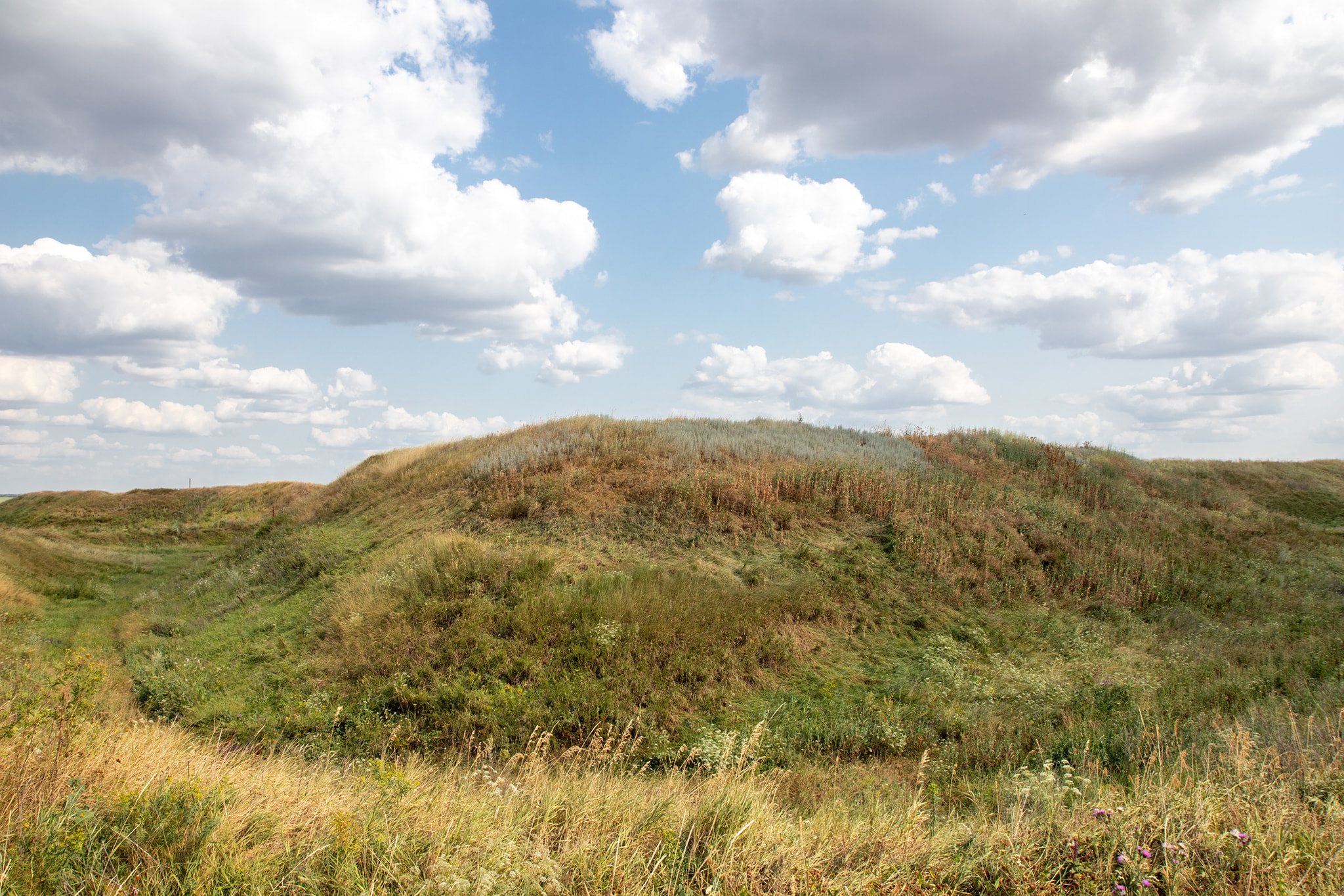
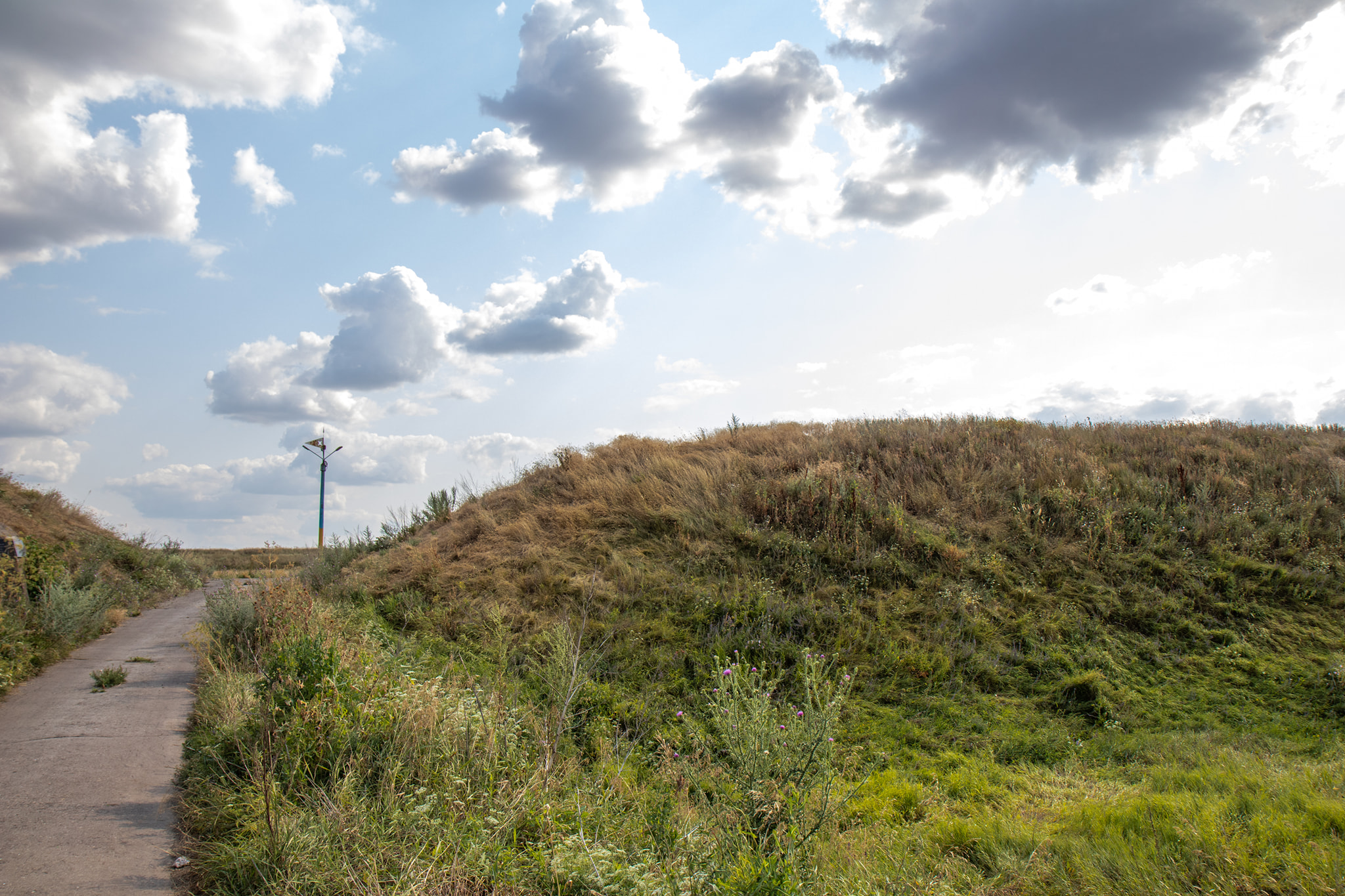
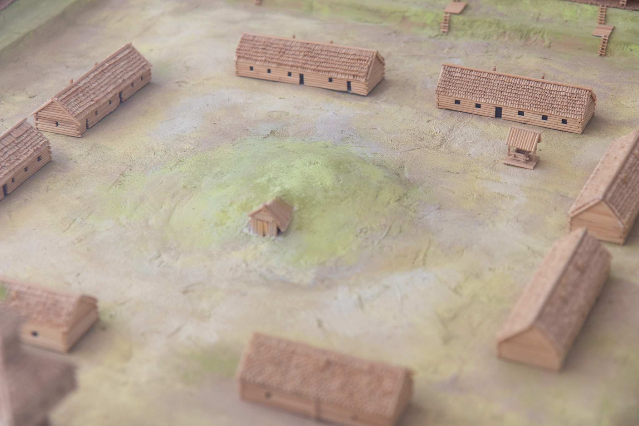
The fortress measures 1,030 meters along one side of the outer rampart that stood up to 5 meters high; the moat was up to 2 meters deep and was filled with water. The structure is barely recognizable when viewed from ground level, but the surviving star-shaped ramparts of fortresses are clearly visible on Google Maps satellite imagery or drone footage.
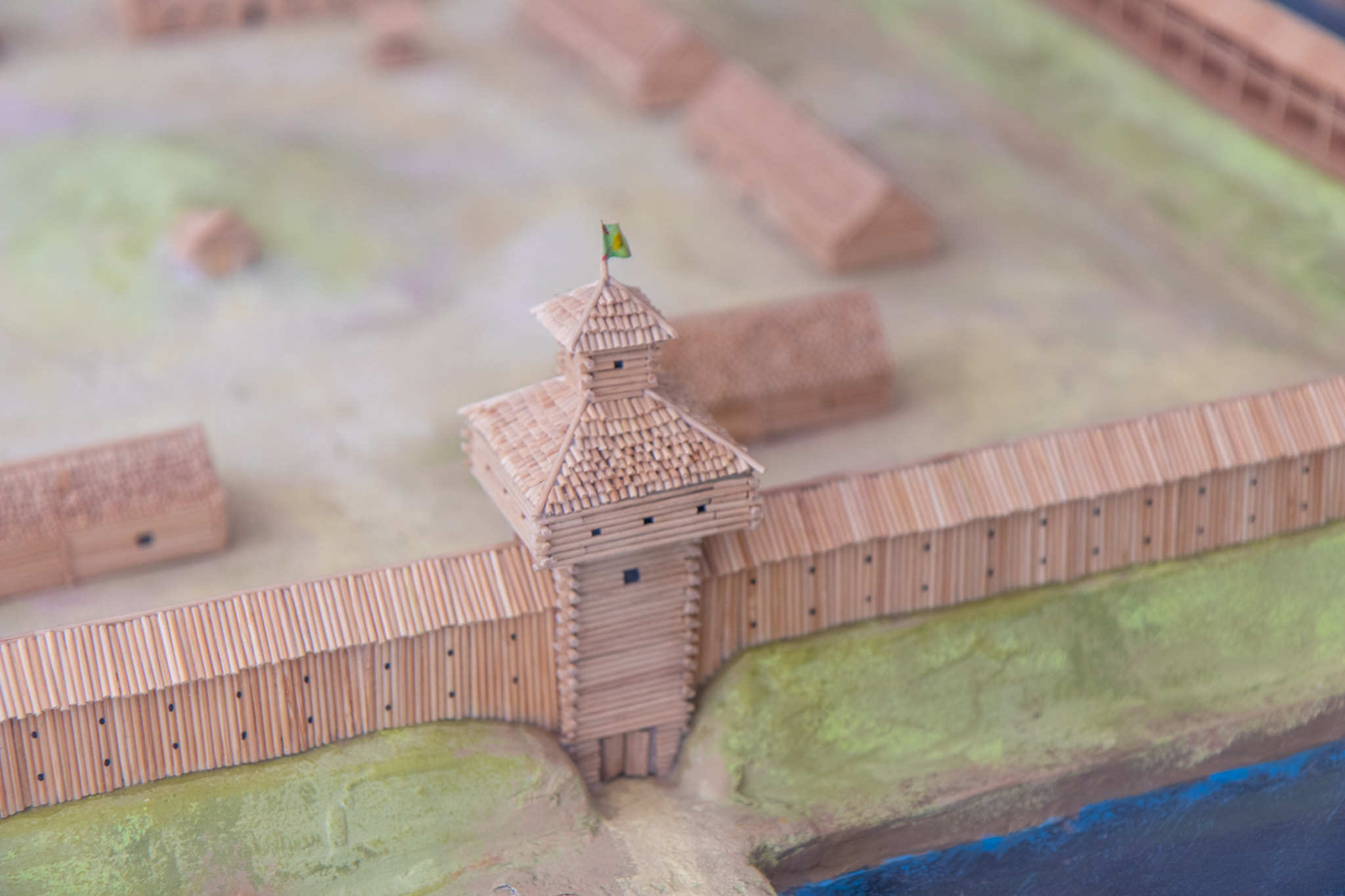
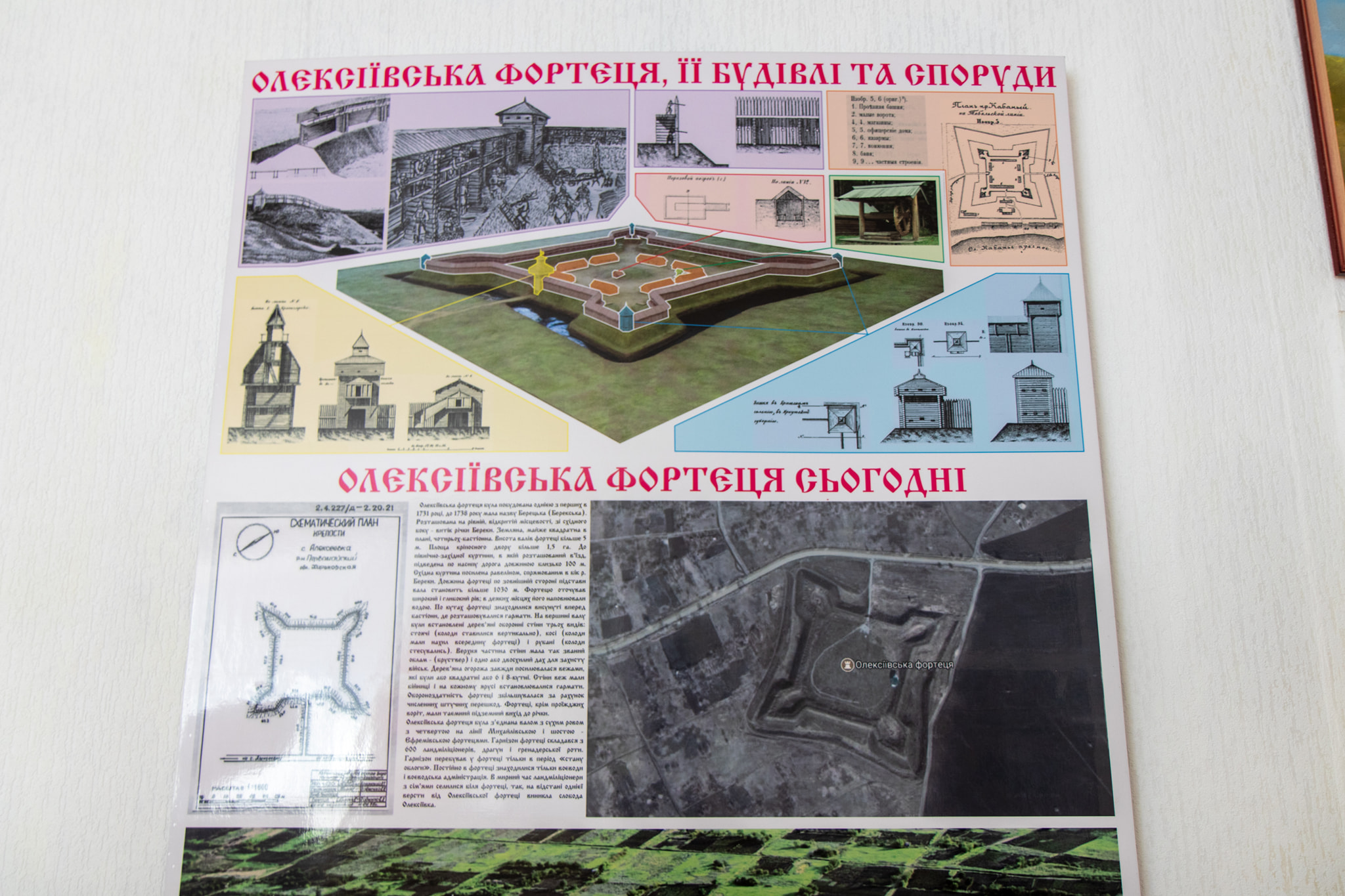
A two-story wooden wall with loopholes once stood above the fortress rampart. Artillery was positioned both in the towers and in the bastions (the crenellations at the corners). The model of the fortress at the Zlatopil Local History Museum was assembled as part of the Participatory Budgeting program in 2018.
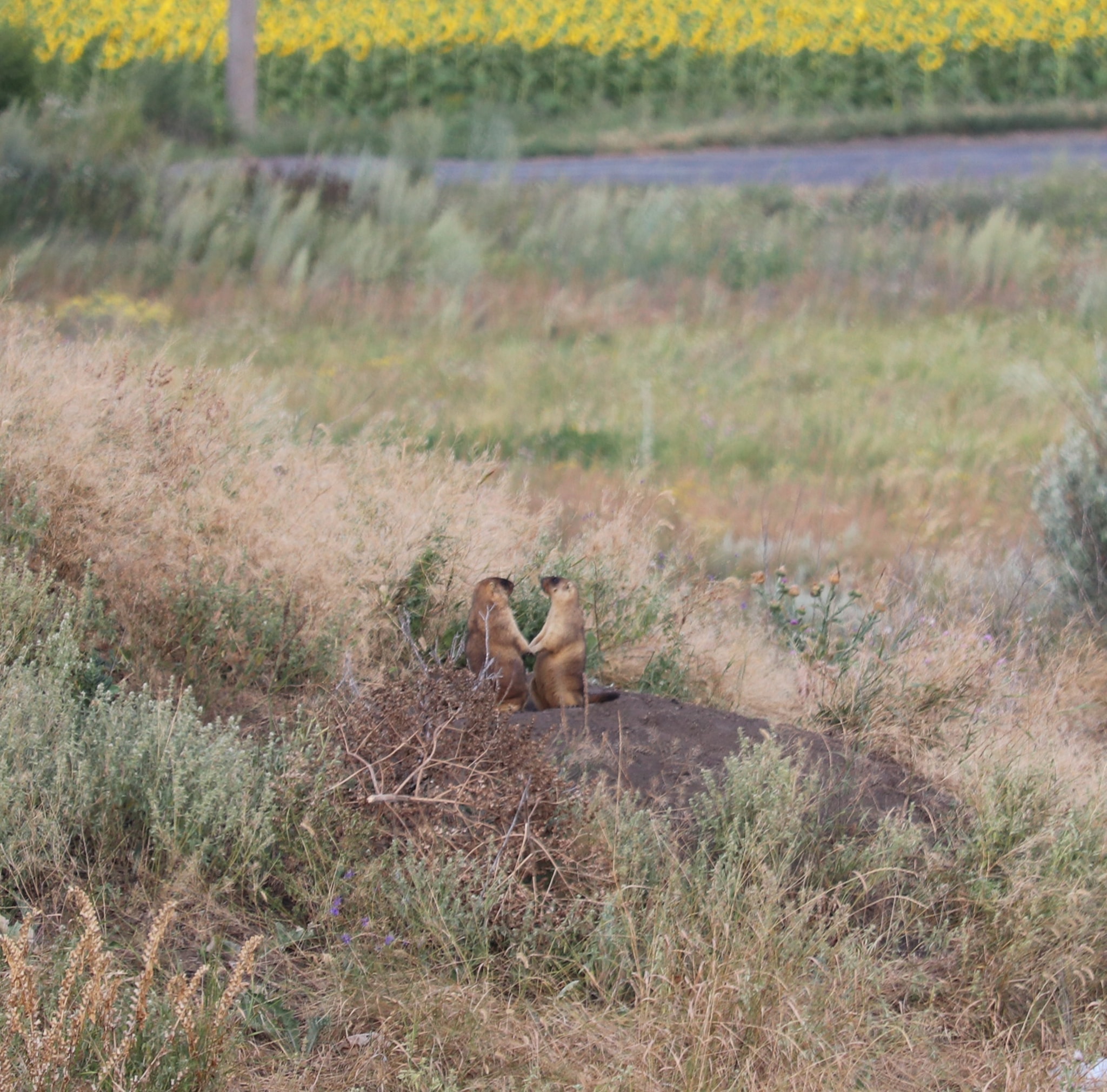
Ethnic-festivals were also held within the fortress grounds, most recently in 2021. Today, however, you can spot many marmots within the grounds of the Fortress.
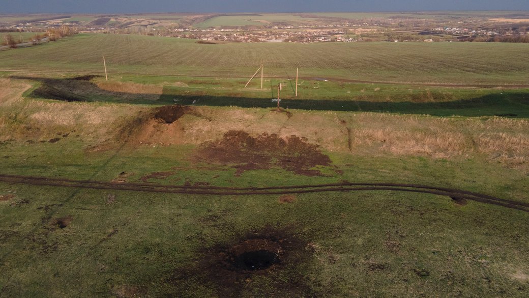
The ramparts of the fortress were damaged by Russian artillery fire in the spring of 2022.